




Date
August 31, 2026
About This Project
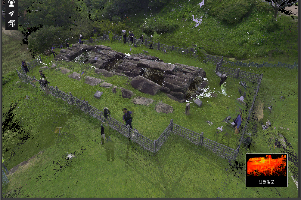
JANGSUNG HDS Performed wide-area 3D laser scanning and precise 3D surveying on the Cheongdo Seokbinggo located in Cheongdo-gun, Gyeongsangbuk-do, to be utilized for safety diagnosis and structural condition analysis.Done.
The Cheongdo Seokbinggo is a traditional stone structure built to store ice, featuring unique structural characteristics unlike ordinary buildings, such as underground and semi-underground spaces and arch structures using stone.
In the safety inspection of such cultural heritage and stone structures, it is important to record the current shape and positional relationship of the structure as objective data.
In this project, Acquired the internal and external conditions of the Cheongdo Seokbinggo as high-density 3D spatial information, establishing precise Point Cloud data that can be utilized for safety inspections and structural condition reviews.Site 3D scanning was conducted for the purpose of doing.
3D laser scanning for building basic safety inspection data
Unlike general buildings, traditional stone structures such as seokbinggo do not have uniform shapes and arrangements of individual stones, and they feature curved arch structures and complex internal spaces.
While traditional measuring methods using tape measures or partial survey points are effective for measuring the distance and height of specific locations, they have limitations in comprehensively recording the irregular shapes of an entire structure.
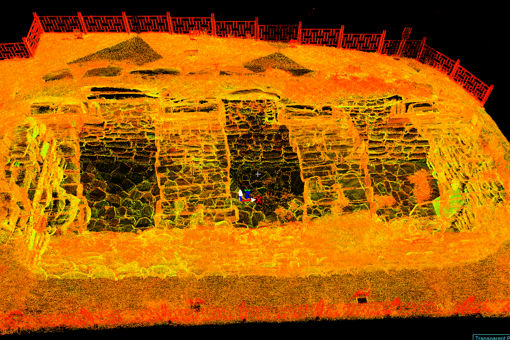
Broadband 3D laser scanning acquires a massive amount of 3D coordinates on a structure's surface in a non-contact manner, Recording the shape of actual structures with high-density Point Cloud dataYou can do it.
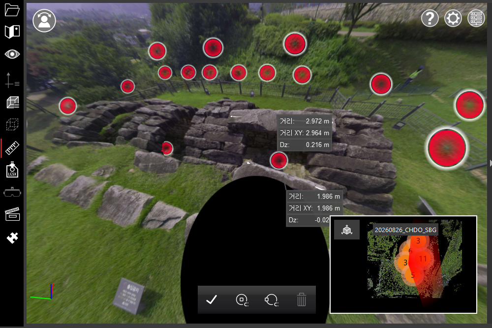
JANGSUNG HDS planned multiple scan positions inside and outside the Cheongdo Seokbinggo, acquired data from each, and registered them into a single coordinate system to build 3D data connecting the entire Seokbinggo.
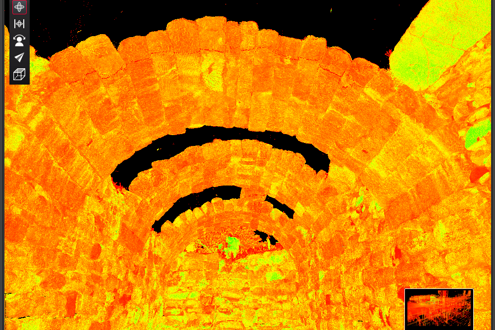
Precision recording of the interior arch structure and stone shapes of the Seokbinggo
In this 3D Scanning, especially the overall spatial geometry composed of the arch structure, walls, floor, openings, and individual stones inside the stone ice storage (seokbinggo)focused on recording in a three-dimensional way.
Data acquired through a laser scanner contains numerous three-dimensional coordinates, making it possible to examine the actual shape of a structure from various directions—something that is difficult to do with simple photographs or two-dimensional drawings alone.
Through this, if necessary, you can generate cross-sections, measure distances and heights, and check the geometry of specific locations. Basic data for various follow-up reviews required for safety diagnosis and structure condition analysiscan be utilized as.
Additionally, if future 3D Scannings are conducted in the same manner, it is also possible to use the data to compare chronological data and review changes in the structure's geometry.
non-contact precision surveying that does not damage cultural heritage
When investigating cultural properties and historical structures, it is of the utmost importance not to damage the objects.
Because 3D laser scanning acquires 3D coordinates of a surface using a laser without directly contacting the structure Non-contact digital recording method suitable for current status documentation and precise surveying of stone cultural heritageis.
It has the advantage of being able to acquire data from a distance, even for particularly complex curved surfaces or locations that are difficult for humans to measure directly, making it possible to record the overall shape of a structure while minimizing the need for on-site workers to access the area.
For this Cheongdo Seokbinggo project as well, we planned the scan locations in consideration of the site structure and safety, and performed internal and external scanning to secure the necessary data.
Construction of objective 3D as-is data based on point cloud
Each set of scan data acquired in the field undergoes a registration process Construct the entire Cheongdo Stone Ice Storage into a single high-density 3D Point Cloud datasetDone.
The built point cloud is characterized by preserving the overall shape of the structure at the time of scanning as 3D coordinates, unlike the method of recording only the dimensions of a few specific points.
Therefore, even after the project is completed, it can be utilized for various follow-up tasks, such as re-verifying necessary locations, taking measurements, and generating data such as floor plans, elevations, and sections.
This 3D data cultural heritage safety diagnosis, condition survey of stone structures, precise actual measurement, deformation review, and basic data for establishing preservation and restoration plans can be utilized in various fields such as.
3D Scan for Safety Diagnosis of Cultural Heritage and Stone Structures
JANGSUNG HDS targets buildings, industrial facilities, cultural properties, and various structures Perform broadband 3D laser scanning and precision 3D as-built surveying servicesam doing.
Based on data acquired in the field, we can build high-density point clouds and generate various types of subsequent data tailored to the project's purpose, such as 3D as-built documentation, cross-section and dimensional analysis, and CAD drafting.
Especially in the case of cultural assets and stone structures where existing drawings are lacking or the actual shapes are complex, utilizing 3D laser scanning allows Establish digital foundational data capable of recording the current state as objective three-dimensional data for use in safety inspections and future maintenance operations.You can do it.
JANGSUNG HDS proposes 3D scanning and data construction methods tailored to the project by reviewing the characteristics of the target structure, site conditions, required precision, and final application purpose.