



About This Project
Samtan Art Mine Vertical Shaft 3D Scan and Spatial Information Construction
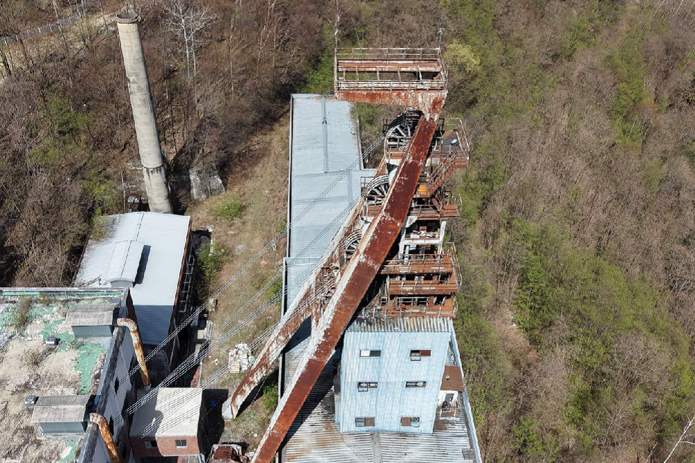
JANGSUNG HDS is located in Jeongseon-gun, Gangwon-do. A 3D Scanning, drone photogrammetry, and reverse engineering project targeting the approximately 60-meter-high vertical shaft tower of Samtan Art Minewas performed.
The purpose of this project is to precisely acquire the current shape and spatial information of existing structures 3D digital data and reverse-engineering CAD datawas to build.
3D Scanning of a structure approximately 60m high
The target structure is about 60m high vertical structureAlso, it was an environment where it was difficult to sufficiently secure data of the entire upper section using only general terrestrial broadband 3D laser scanning from the ground.
Accordingly, the lower and middle sections of the structure broadband 3D laser scannerusing [this/which], acquire high-density Point Clouds, and for high-rise sections where data acquisition is difficult with ground scanning alone, Drone photography and photogrammetry The technology has been applied.
by registering data acquired through different methods into a single coordinate system, the entire vertical shaft tower build 3D spatial informationDone.
Building High-Rise Data Using Drone Photogrammetry
Elevated structures may have sections that are difficult for workers to directly access or where it is hard to install a 3D scanner. In this project, to acquire shape data of such high-rise areas, Drone Photogrammetry Technology was utilized.
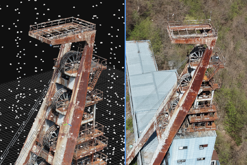
After capturing the exterior of the structure from multiple angles using a drone, photogrammetry data was processed to generate 3D shape information, which was then combined with 3D Scanning data acquired from the ground.
Through this Hybrid 3D surveying method combining the advantages of terrestrial 3D laser scanning and drone photogrammetry, we were able to build data for the entire target structure.
Point Cloud-based Reverse Engineering CAD Data Creation
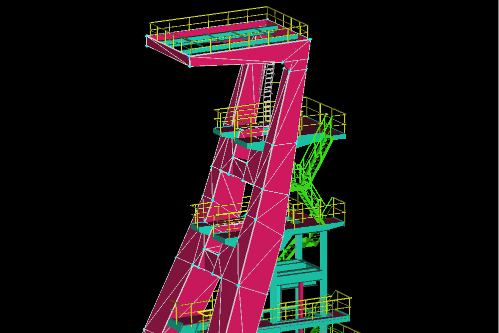
acquired in the field 3D Scanning point cloud and drone photogrammetry dataBased on this, the actual shape of the target structure was analyzed and reverse engineering was performed.
Ultimately reflecting the current state of the on-site structure 3D Reverse Engineering CAD datawas produced and established so that it can be used for future design, structural review, spatial information utilization, and facility management.
Key Performance Tasks
- 3D Scanning of approximately 60m high vertical shaft tower
- Broadband 3D laser scanning
- Drone aerial photography
- Drone Photogrammetry
- Construction of 3D shape data for high-rise sections
- 3D Scanning and photogrammetry data registration
- High-density Point Cloud Construction
- Point Cloud based reverse engineering
- Creation of 3D CAD data
JANGSUNG HDS performs on the ground Combining 3D laser scanning as well as drone photogrammetry and reverse engineering technologies, We build 3D spatial information for high-rise structures, industrial facilities, and large-scale structures that are difficult to access using conventional surveying methods.
Date
June 16, 2026